Geographic Information Systems

SANDAG has a well-recognized and award-winning Geographic Information System (GIS) program. Having used GIS technology since the early 1970s, we continue to apply GIS to support many planning applications including demography, transportation, land use, environment, public safety, and public facility siting and management. 

Through the San Diego Regional GIS Council, we work with our members and other agencies to share GIS expertise, information, applications, and data. The Council has formed several subcommittees over the years to research new technologies in specific topical areas and share the results with other agencies in the region. We make many GIS layers available to the public and have instituted cooperative data-sharing agreements with other federal, state, and local agencies. Please read the Data Terms of Use.

The Regional GIS Data Warehouse provides data for everything from addresses to zoning, including roads, property, parks, lakes, topography, census, and dozens of other layers—more than 400 layers in 30 different categories.

The public facing data are free to download after accepting the data disclaimer which is presented to each user upon entering the Regional GIS Data Warehouse. The data are stored as compressed shapefiles (SHP). Metadata (information about the data) are provided in PDF format.

A complete list of available layers can be downloaded as an Excel or PDF file. Please review the SANDAG GIS Data Disclaimer prior to using SANDAG data and web services.

SANDAG and the San Diego Geographic Information Source (SanGIS) are publishing several of the most popular data layers from the Regional GIS Data Warehouse as GIS web services. Visit the SANDAG/SanGIS Open Data Portal to access these services, along with links to other regional GIS community resources. SanGIS is a Joint Powers Authority of the City of San Diego and the County of San Diego. Please review the SANDAG GIS Data Disclaimer prior to using SANDAG data and web services.

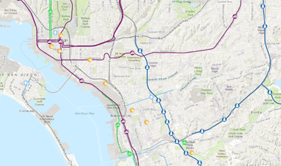
SANDAG publishes GIS data and imagery services, including administrative and district boundaries, land use, basemaps, imagery, and others. The SANDAG web map gallery provides an easy-to-use catalog to explore many of our web maps, GIS data and imagery services, and custom applications.

To view currently available services, use the SANDAG ArcGIS REST services page which provides the location and supporting information for each service available. SANDAG GIS services can also be used directly in most GIS software. Refer to the help document for detailed instructions. Please review the SANDAG GIS Data Disclaimer prior to using SANDAG data and web services.

The SANDAG Highway Hot Spots & Volumes Tracker is a one-stop data source that tracks weekday month-by-month vehicle miles traveled on local highways, including traffic speeds and average daily traffic volumes at ten traffic hotspots.

The SANDAG SB 743 VMT Maps provide an estimate of personal vehicle travel by residents and employees within the San Diego region. These maps are an interpretation of the Technical Advisory on Evaluating Transportation Impacts in CEQA guidelines provided by the California Office of Planning and Research (OPR). Please read the SB 743 Data Disclaimer prior to using the interactive map. Additional information can be found in the SB 743 Documentation.

Get quick access to forecasted average weekday traffic volumes for freeways, freeway ramps, and major roads with the SANDAG Traffic Forecast Information Center. Select individual roadway segments to obtain additional information including street name, type of roadway, number of lanes, and posted speed. Recent enhancements include trip generation and land use forecasts for small geographic areas.

A collaborative effort between SANDAG and SanGIS, the online Parcel Lookup Tool and geographic boundary viewer provides a wide range of publicly available data layers such as property (parcels), district and municipal boundaries, and census geographies. The interactive map also includes the regional basemap. The underlying data available through the interactive map are updated monthly. Please note that Parcel Lookup Tool performance may vary depending on the computer operating system or the web browser being used.